THE Phase One reclamation of Island A (approximately 1,200 acres) is scheduled to begin in May or June, said Deputy Chief Minister I Datuk Ahmad Zakiyuddin Abdul Rahman.
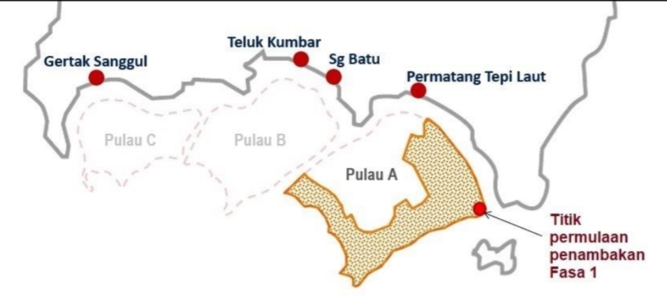
The tri-islands (Islands A, B and C) of the Penang South Reclamation (PSR) project will be located at the south-end of the Penang island, measuring a total of 4,500 acres in land size. Island A will be 2,300 acres in size, Island B will be 1,400 acres and Island C will be 800 acres.
It would take about nine years to fully reclaim Island A.
“The Environmental Management Plan (EMP) of the PSR is in its final stage of receiving the approval from the Department of Environment (DoE).
“The department has its own SOPs and is professional in its work. We are not worried about that,” Ahmad Zakiyuddin replied a question from a reporter on the possibility of the EMP being delayed deliberately.
He said that there was no reason to speculate the matter.
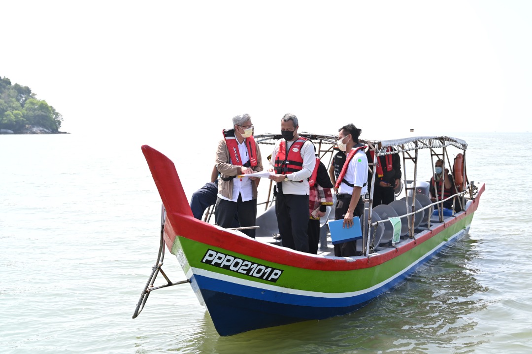
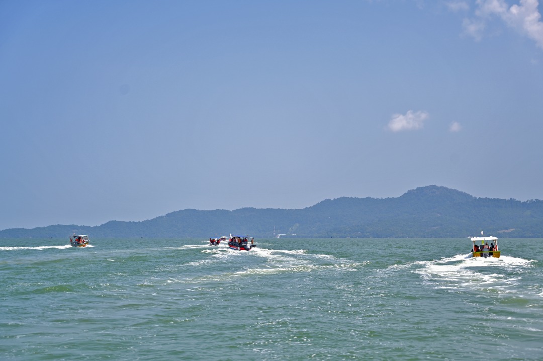
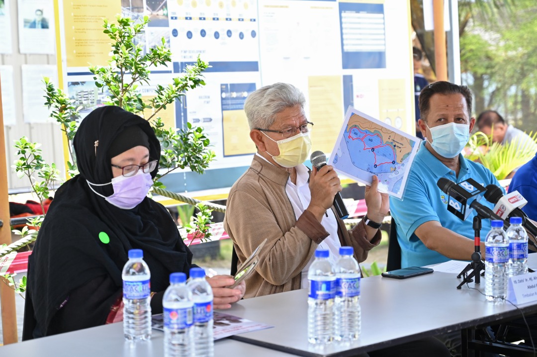
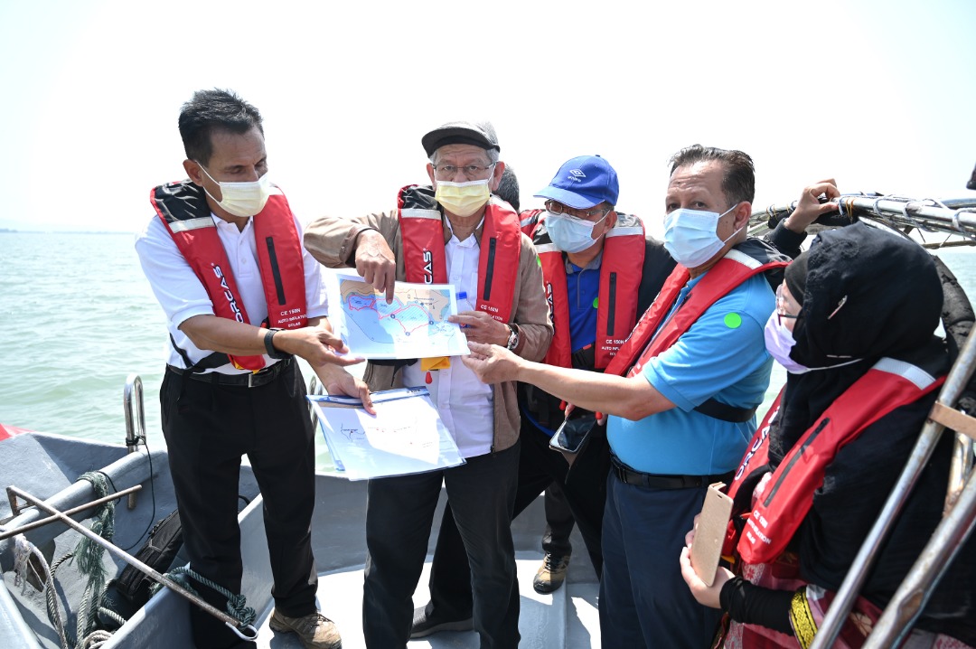
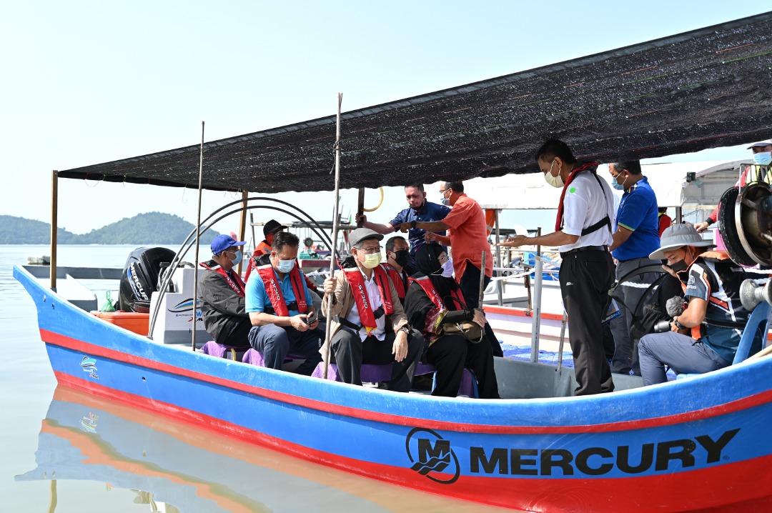
Ahmad Zakiyuddin, state executive council members Datuk Abdul Halim Hussain and Dr Norlela Ariffin, Penang Infrastructure Corporation PIC chief executive officer Datuk Seri Farizan Darus, together with the media and other representatives from the government agencies were taken on boats to check out the proposed site of Island A this morning.
They visited three points of the site – Point One (the easternmost point of Island A), Point Two (the southernmost point of Island A) and Point Three (the westernmost point of Island A).
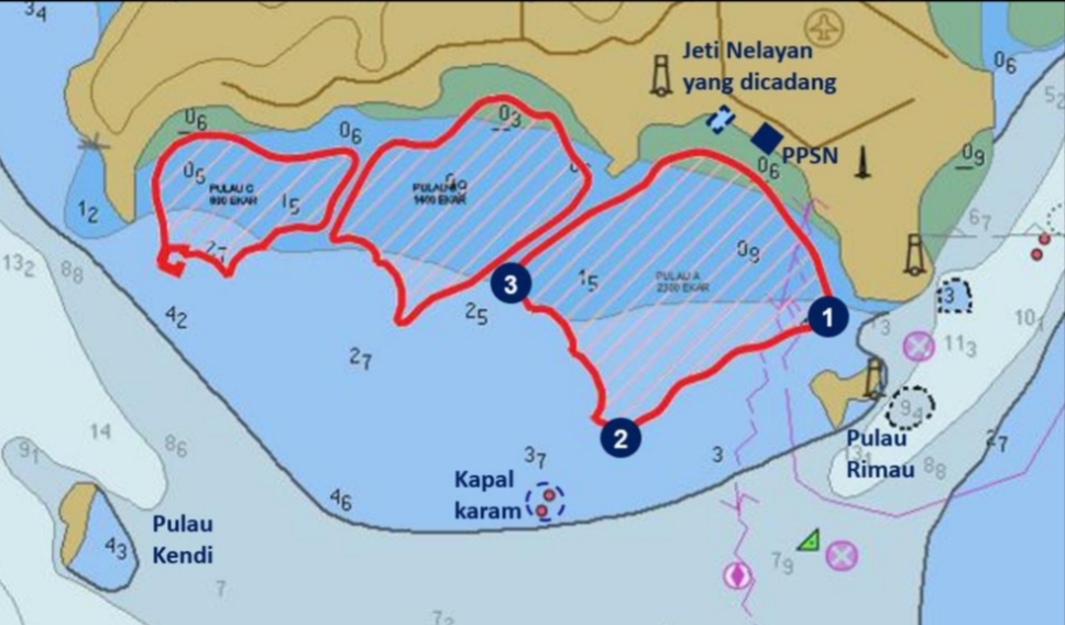
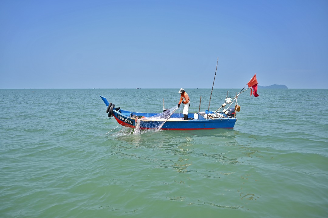
The delegates were able to check out the 250m water channel (distance from the shore) for the fishermen to conduct fishing activities and to navigate towards the deeper end of the sea, on their way to Point One.
Point One is located about 600m from Pulau Rimau.
From Point One, the boats headed to Point Two where it is approximately 4.6km from the shore of Permatang Damar Laut.
Point Two is located about 1.5km to 2km from a ship wreck spot.
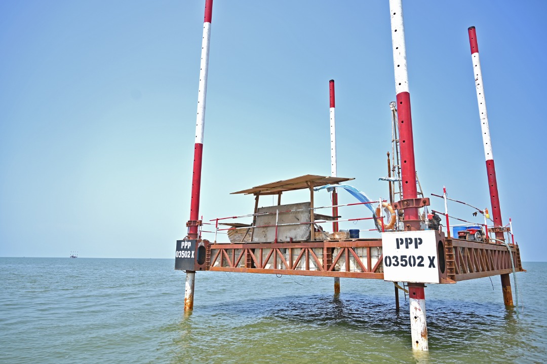
The boats then travelled to Point Three before heading to a soil investigation (SI) platform where the seabed soil samples are collected to obtain data for investigation.
The entire journey took about an hour.
Prior to the journey, Ahmad Zakiyuddin, Abdul Halim and Dr Norlela together with Farizan and other VIPs tested a boat (measuring 27ft-long, with a 90 horsepower engine), which is an example of the boat to be offered to the tekong (boat skippers) of the Tier One fishing units as ex-gratia.
The Tier One fishing units are from Permatang Tepi Laut, Sungai Batu, Teluk Kumbar and Gertak Sanggul.
Ahmad Zakiyuddin said the boat was comfortable and it was a smooth ride.
Story by Christopher Tan
Pix by Ahmad Adil Muhamad